
Search
Search Results
Image
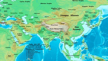
Map of the Eastern Hemisphere (1 CE)
Map showing the political division in the Eastern hemisphere in 1 CE. The Han dynasty was almost at its peak in terms of geographical expansion.

Interview
Interview: Gods of Thunder by Tim Pauketat
Join World History Encyclopedia as they chat with Tim Pauketat all about his new book Gods of Thunder: How Climate Change, Travel, and Spirituality Reshaped Precolonial America, published by Oxford University Press. Kelly: Thank you so...

Video
Ancient History of Winter Solstice Traditions and Sites
The winter solstice, falling in December in the Northern hemisphere and June in the Southern hemisphere, is the shortest day and longest night of the year. The winter solstice, also referred to as ‘midwinter’ is associated with the idea of...
Definition
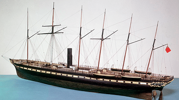
SS Great Britain
The SS Great Britain was a steam-powered ship designed by Isambard Kingdom Brunel (1806-1859) which sailed on its maiden voyage from Liverpool to New York in May 1845. It was the largest passenger ship in the world at the time and showed...
Definition
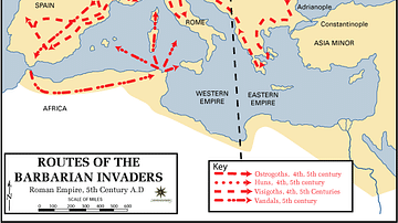
Western Roman Empire
The Western Roman Empire is the modern-day term for the western half of the Roman Empire after it was divided in two by the emperor Diocletian (r. 284-305 CE) in c. 285/286 CE. The Romans themselves did not use this term. At its height (c...
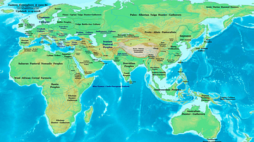
Image
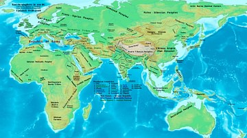
The Eastern Hemisphere, 100 BC
A map showing the major empires, kingdoms, tribes, and ethnic groups of the Eastern Hemisphere in 100 BC.
Image
Eastern Hemisphere in 1300 BC
It shows ancient Africa, Asia, Europe, Oceania in 1300 BC.

Video
The Rise & Fall of the Inca Empire - Gordon McEwan
View full lesson: https://ed.ted.com/lessons/the-rise-and-fall-of-the-inca-empire-gordon-mcewan It was the western hemisphere's largest empire ever, with a population of nearly 10 million subjects. Yet within 100 years of its rise in the...
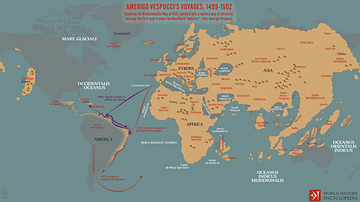
Image
Amerigo Vespucci's Voyages between 1499-1502
A map depicting the two transatlantic voyages of Amerigo Vespucci between 1499 and 1502. It is based on the 1507 map by Martin Waldseemüller, a German clergyman and cartographer, which first referred to the southern hemisphere where Amerigo...
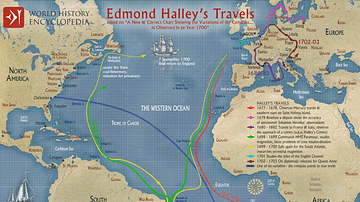
Image
Edmond Halley’s Travels
A map illustrating the travels of the English polymath (astronomer, mathematician, geophysicist, and meteorologist, …) Edmond Halley (1656–1742) during the late 17th and early 18th centuries. From his earlier voyage on an East India Company...