
Search
Search Results
Article
Observatories in the Scientific Revolution
The foundation of observatories during the Scientific Revolution (1500-1700) followed a process of evolution from entirely independent observatories operated by a single astronomer to private observatories which received state or private...

Definition
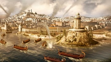
Roman Naval Warfare
Military supremacy of the seas could be a crucial factor in the success of any land campaign, and the Romans well knew that a powerful naval fleet could supply troops and equipment to where they were most needed in as short a time as possible...
Definition
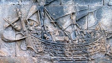
Carthaginian Naval Warfare
The Carthaginians were famed in antiquity for their seafaring skills and innovation in ship design. The empire their navy protected stretched from Sicily to the Atlantic coast of Africa. Able to match the tyrants of Sicily and the Hellenistic...
Article
Naval Warfare in Ancient India
The navy in ancient India carried out three roles: it was used to transport troops to distant battlefields, participate in actual warfare, and was primarily meant for protecting the kingdom's trade on sea and navigable rivers and the maritime...
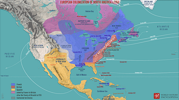
Image Gallery
5 Maps on the Origins of the United States
In this gallery of five maps, we examine the creation and expansion of the United States from the colonization of North America by European powers to the routes of the explorers who pushed ever westwards to the Pacific coast. Here we can...

Definition
Indian Princely States
The Indian Princely states (aka Native States or Princely India) were those states in the Indian subcontinent the British did not conquer but which were typically bound by treaty first to the East India Company and then to the British Crown...
Image
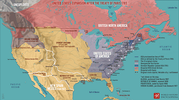
United States Expansion after the Treaty of Paris in 1783
A map illustrating the expansion of the United States of America following the Treaty of Paris (September 3, 1783), which ended the War of the American Revolution, recognized U.S. independence, and granted it sizeable additional territory...
Image
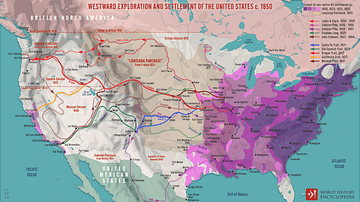
Westward Exploration and Settlement of the United States c.1850
A map illustrating the patterns and routes of westward exploration and settlement in the United States after the “Louisiana Purchase” from France in 1803. As Napoleonic dreams of a great North American Empire gave way to French hegemonic...
Image
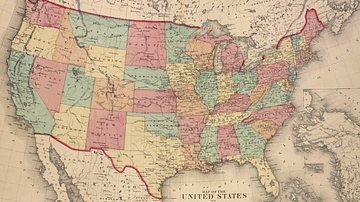
Map of the United States, 1874
A map of the United States, showing each of its states, published by D.G. Beers & Co. in 1874.
From the Lionel Pincus and Princess Firyal Map Division, The New York Public Library.
Image
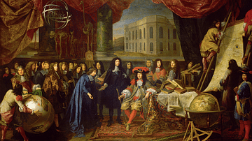
Establishment of the French Academy and Paris Observatory
A 17th-century painting by Henri Testelin titled Establishment of the French Academy of Sciences and of Paris Observatory. Louis XIV of France (r. 1643-1715) is shown being presented the founding members of the Academy and Observatory (shown...