
Search
Search Results
Image
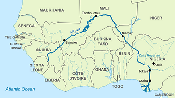
Map of Niger River
The Niger River is the most important river in West Africa, and is the third longest river in Africa after the Nile River and Congo River. Known for its distinctive "boomerang" shape, the Niger River flows from the Guinea Highlands to the...
Definition
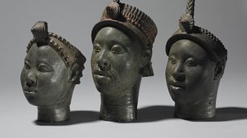
Ife
Ife (aka Ile-Ife) was an ancient African city which flourished between the 11th and 15th century CE in what is today Nigeria in West Africa. Ife was the capital and principal religious centre of the Yoruba kingdom of Ife, which prospered...
Image
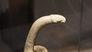
Bird Shaped Pestle
A bird-shaped pestle. Stone, 6000-2000 BCE. Oro Province, Papua New Guinea. Most modern vegetables and cereals were first cultivated around 10,000 years ago. This pestle was made for grinding taro, one of the crops farmers in Papua New...
Article
The Dutch Discovery of Australia
17th-century Dutch East India Company (Vereenigde Oostindische Compagnie or VOC) navigators were the first Europeans to set foot on Australian soil. Although there is a strong theory that the Portuguese explorer, Cristóvão de Mendonça (1475-1532...
Article
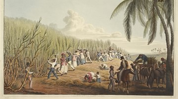
Slavery in Plantation Agriculture
The first plantations in the Americas of sugar cane, cocoa, tobacco, and cotton were maintained and harvested by African slaves controlled by European masters. When African slavery was largely abolished in the mid-1800s, the center of plantation...
Article
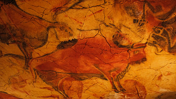
The Meaning of European Upper Paleolithic Rock Art
Rock art (also known as parietal art) is an umbrella term which refers to several types of creations including finger markings left on soft surfaces, bas-relief sculptures, engraved figures and symbols, and paintings onto a rock surface...
Image
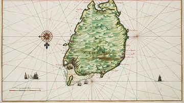
Historical Map of São Tomé
A 1665 map drawn by Johannes Vingboons of the island of São Tomé in the Gulf of Guinea in West Africa. The island was a Portuguese colony from c. 1486 to 1975. (National Archives of the Netherlands)
Definition
Olmec Civilization
The Olmec civilization, located in ancient Mexico, prospered in Pre-Classical (Formative) Mesoamerica from c. 1200 BCE to c. 400 BCE. Monumental sacred complexes, massive stone sculptures, ball games, the drinking of chocolate, and animal...
Definition
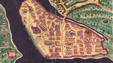
Portuguese Cochin
Cochin, located on the southwest coast of India, was a Portuguese colony from 1503 to 1663. Known to the Portuguese as Cochim, it was one of several important cities on India’s Malabar Coast and a great trade centre for spices like pepper...
Definition
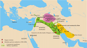
Akkad and the Akkadian Empire
Akkad was the seat of the Akkadian Empire (2334-2218 BCE), the first multi-national political entity in the world, founded by Sargon the Great (r. 2334-2279 BCE) who unified Mesopotamia under his rule and set the model for later Mesopotamian...