
Search
Search Results
Article
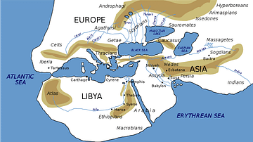
Ancient Geography of India
The first text in Greek devoted entirely to India was written by Ctesias in the fourth century BCE. Only fragments of it survive. Yet he was probably the most widely quoted author on India, although Aristotle treated him with contempt. However...
Definition
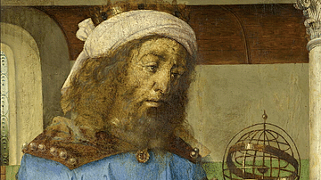
Claudius Ptolemy
Claudius Ptolemy (c. 100 to c. 170 CE) was an Alexandrian mathematician, astronomer, and geographer. His works survived antiquity and the Middle Ages intact, and his theories, particularly on a geocentric model of the universe with planets...
Image
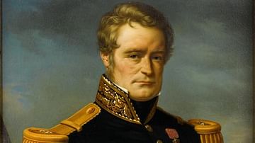
Dumont d'Urville
Jules Sébastien César Dumont d'Urville (1790-1842) was born at Condé sur Noireau, Normandy, France. He was a French explorer and navigator who made three voyages of discovery to Aotearoa New Zealand between 1827 and 1840. Dumont d'Urville...
Image
The Escape of Henri de Rochefort by Manet
An 1880-1 oil on canvas painting, The Escape of Henri de Rochefort, by Edouard Manet (1832-83), the French modernist painter. Henri de Rochfort escaped from the penal colony of New Caledonia in 1874, crossing the Indian Ocean in a small boat...

Image Gallery
A Gallery of Historical Maps
This gallery of 30 maps traces the history of cartography, with examples of maps made by cultures from the Paleolithic to the early modern period. The maps cover cities, states, continents, sometimes the entire world as it was known at the...
Image
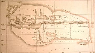
Eratosthenes' Map of the World
A reconstructed map of the known world according to Eratosthenes (276-195 BCE), the Greek Alexandrian scholar from Cyrene. (Bunbury, E.H., 1811-1895, 'A History of Ancient Geography among the Greeks and Romans from the Earliest Ages till...
Image
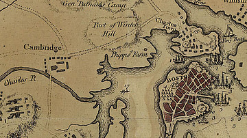
Map of Boston, 1775
A map of Boston and the surrounding country in 1775, during the time of the Battles of Lexington and Concord and the Battle of Bunker Hill. By J. DeCosta, 29 July 1775.
Library of Congress Geography and Map Division, Washington D.C.
Image
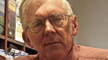
Duane Roller
Duane W. Roller is Professor Emeritus of Classics at The Ohio State University and the author of numerous books, including Empire of the Black Sea: The Rise and Fall of the Mithridatic World, Cleopatra: A Biography, Cleopatra's Daughter...
Image
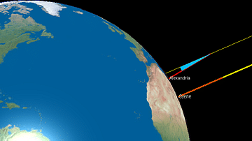
Eratosthenes' Calculation of the Earth's Circumference
An illustration showing Greek scientist Eratosthenes' method for calculating the circumference of the Earth. By measuring the angle of a shadow in one location (Alexandria) and comparing at the same time with a second point (Syene) where...
Image
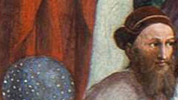
Hipparchus of Nicea by Raphael
A detail from Raphael's 'The School of Athens' (c. 1509 CE) showing Greek astronomer, mathematician and geographer Hipparchus of Nicea (c. 190-120 BCE).