
Search
Search Results
Article
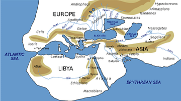
Ancient Geography of India
The first text in Greek devoted entirely to India was written by Ctesias in the fourth century BCE. Only fragments of it survive. Yet he was probably the most widely quoted author on India, although Aristotle treated him with contempt. However...
Definition
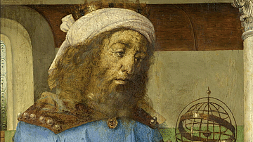
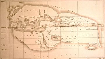
Claudius Ptolemy
Claudius Ptolemy (c. 100 to c. 170 CE) was an Alexandrian mathematician, astronomer, and geographer. His works survived antiquity and the Middle Ages intact, and his theories, particularly on a geocentric model of the universe with planets...
Definition
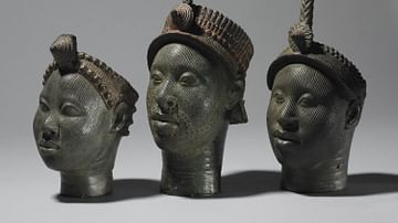
Ife
Ife (aka Ile-Ife) was an ancient African city which flourished between the 11th and 15th century CE in what is today Nigeria in West Africa. Ife was the capital and principal religious centre of the Yoruba kingdom of Ife, which prospered...
Image
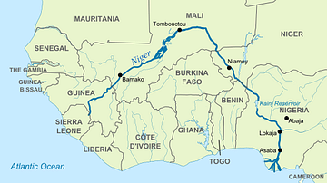
Map of Niger River
The Niger River is the most important river in West Africa, and is the third longest river in Africa after the Nile River and Congo River. Known for its distinctive "boomerang" shape, the Niger River flows from the Guinea Highlands to the...
Image
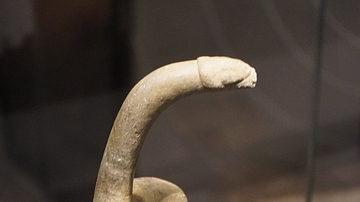
Bird Shaped Pestle
A bird-shaped pestle. Stone, 6000-2000 BCE. Oro Province, Papua New Guinea. Most modern vegetables and cereals were first cultivated around 10,000 years ago. This pestle was made for grinding taro, one of the crops farmers in Papua New...
Article
The Dutch Discovery of Australia
17th-century Dutch East India Company (Vereenigde Oostindische Compagnie or VOC) navigators were the first Europeans to set foot on Australian soil. Although there is a strong theory that the Portuguese explorer, Cristóvão de Mendonça (1475-1532...
Article
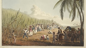
Slavery in Plantation Agriculture
The first plantations in the Americas of sugar cane, cocoa, tobacco, and cotton were maintained and harvested by African slaves controlled by European masters. When African slavery was largely abolished in the mid-1800s, the center of plantation...
Article
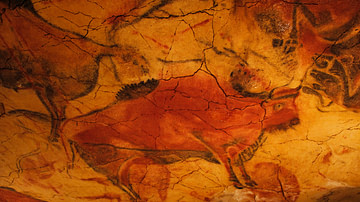
The Meaning of European Upper Paleolithic Rock Art
Rock art (also known as parietal art) is an umbrella term which refers to several types of creations including finger markings left on soft surfaces, bas-relief sculptures, engraved figures and symbols, and paintings onto a rock surface...

Image Gallery
A Gallery of Historical Maps
This gallery of 30 maps traces the history of cartography, with examples of maps made by cultures from the Paleolithic to the early modern period. The maps cover cities, states, continents, sometimes the entire world as it was known at the...
Image
Eratosthenes' Map of the World
A reconstructed map of the known world according to Eratosthenes (276-195 BCE), the Greek Alexandrian scholar from Cyrene. (Bunbury, E.H., 1811-1895, 'A History of Ancient Geography among the Greeks and Romans from the Earliest Ages till...