
Search
Search Results

Definition
Trephination
Trephination (also known as trepanning or burr holing) is a surgical intervention where a hole is drilled, incised or scraped into the skull using simple surgical tools. In drilling into the skull and removing a piece of the bone, the dura...
Video
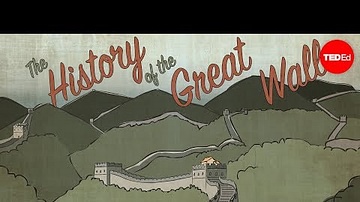
What Makes the Great Wall of China So Extraordinary - Megan Campisi & Pen-Pen Chen
View full lesson: http://ed.ted.com/lessons/what-makes-the-great-wall-of-china-so-extraordinary-megan-campisi-and-pen-pen-chen The Great Wall of China is a 13,000-mile dragon of earth and stone that winds its way through the countryside...

Video
The incredible history of China's terracotta warriors - Megan Campisi and Pen-Pen Chen
This is a very good video on the Terracotta Warriors of China from the Qin Dynasty. It is less than five minutes long but provides a very thorough history lesson on who Shi Huangti was, why he had the terracotta army built, and how the tomb...
Image
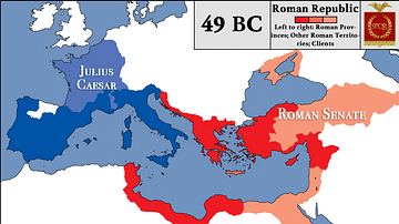
Roman Republic at the Beginning of Caesar's Civil War
This map depicts the territories under Julius Caesar and Roman Senate in the wake of the outbreak of Caesar's Civil War in 49 BCE in the Roman Republic. Caesar crossed the Rubicon and marched on Rome while Pompey, supported by the Senate...
Image
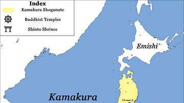
Major Temples and Shrines of Japan circa 1200 CE, Kamakura Shogunate
This map depicts all major Buddhist temples and Shinto shrines of Japan around the year 1200 CE. Notice that many renowned temples (such as the famous Kinkaju-ji) have not yet been built at that time. The map highlights the city of Kamakura...
Image
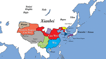
Three Kingdoms Period of China and the Rise of Xianbei in the year 229 CE
This map depicts the boundaries of all major civilizations in East Asia at the beginning of the Three Kingdoms Period of China, with italics indicating nomadic bands and other tribal societies. Following the collapse of Han Dynasty in 220...
Image
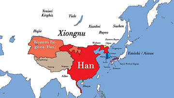
East Asia in the year 1 CE
This map shows the boundaries of all major civilizations in East Asia at the beginning of the first millennium, with italics indicating nomadic bands and other tribal societies.

Image
Khan Tengri
The mountain Khan Tengri, located in the Tian Shan mountain range on the China—Kyrgyzstan—Kazakhstan border. Height: 6,995 m (22,949 ft). It is likely named after the ancient Mongol sky god and supreme deity Tengri.
Image
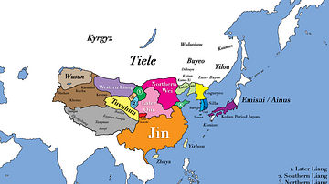
East Asia in 400 CE
This map shows all major civilizations of East Asia at the beginning of 4th century CE. Italicized texts indicate nomadic bands or tribal societies.
Image
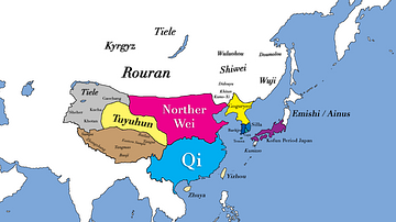
East Asia in 500 CE
This map shows the territories of all major civilizations in East Asia in the year 500 CE. Italicized texts indicate nomadic bands or tribal societies.