
Search
Search Results
Image
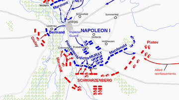
Battle of Leipzig, 16 October 1813
Actions of the first day of the Battle of Leipzig, 16 October 1813. Map by Wikipedia user Andrei nacu, 2007.
Image
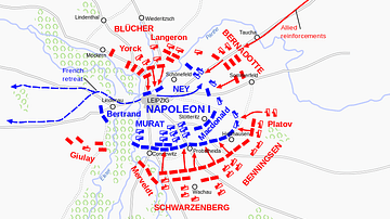
Battle of Leipzig, 18 October 1813
Actions on the second day of the Battle of Leipzig, 18 October 1813. Map by Wikipedia user Andrei nacu, 2008.

Image
Roman Empire in 117 CE
Map of the Roman Empire at its maximum extent in 117 CE, under the rule of Trajan.
Image
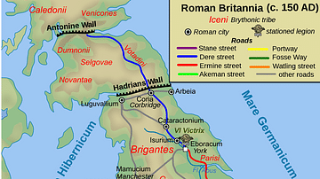
Map of Roman Britain, 150 AD
Map of Roman Britain ca. 150 AD, showing the main Roman roads, cities, and Brythonic tribes.
Image
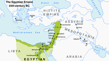
Map of the New Kingdom of Egypt, 1450 BCE
A map showing the maximum territorial extent of the New Kingdom of Egypt, ca. 1450 BCE.
Image
Map of the Roman Empire in 125 CE
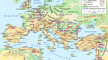
A map of the Roman Empire and Europe in 125 CE, at the time of Roman emperor Hadrian.
"Barbarian" names and locations are given as found in the works of Tacitus (written c. 100 CE).
Image
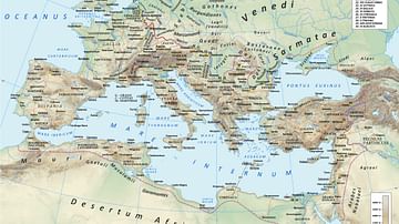
Roman Road Network
A map showing the principal routes of the Roman road network in 125 CE.
Image
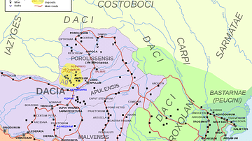
Map of Roman Dacia
Map of the Roman province of Dacia, part of modern-day Romania and Serbia, between the era of Trajan (106 CE) and the evacuation of the province in 271 CE. Roman settlements and legion garrisons with Latin names included.
Image
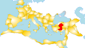
Map of the Roman Province of Galatia
A map showing the position of the province of Galatia within the Roman Empire.
Image
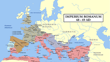
Map: Year of the Four Emperors
Map of the Roman Empire during 69AD, the Year of the Four Emperors. Coloured areas indicate provinces loyal to one of four warring generals.