
Search
Search Results
Article
A History of Svalbard
Svalbard is an archipelago in the Arctic Ocean on the northwest corner of the Barents Shelf. It is 800 kilometres (497 mi) north of mainland Norway and sits roughly midway between the top of Norway and the North Pole. It is bordered by Greenland...
Image
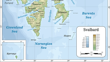
Topographic map of Svalbard
Topographic map of Svalbard archipelago (formerly known as Spitsbergen).
Image
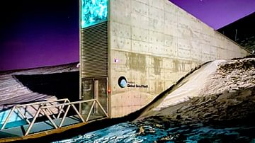
Global Seed Vault in Longyearbyen
The entrance to the Global Seed Vault built in 2008 in Longyearbyen, Svalbard.
Image
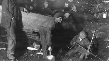
Kings Bay Kull Compagni's Mining Operations on Svalbard - 1918
From Kings Bay Kull Compagni's mining operations on Svalbard. Photo: Sigvald Moa. From the archive of Kings Bay Kull Compagni AS (PA-1632, series D, pcs. 1, 2_8).
Image
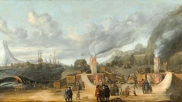
A Whale Oil Refinery at Smeerenburg, Svalbard
The whale oil refinery of the Amsterdam chamber of the Greenland Company on Amsterdam Island off the coast of Spitsbergen. Oil on canvas, 1639.
Image
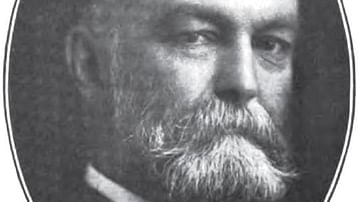
John Munro Longyear
John Munro Longyear (1850-1922), who was the central figure behind the Arctic Coal Company which surveyed and mined coalfields on Spitsbergen, now Svalbard, from 1905 to 1916. Longyearbyen - the world's northernmost settlement and largest...
Image
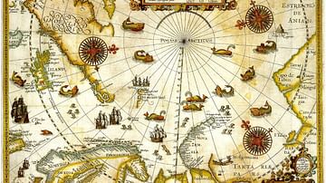
1598 Map of the Three Arctic Voyages (1594–1596) by Willem Barentsz
1598 Map of the Three Arctic Voyages (1594–1596) by Willem Barentsz. Spitsbergen (now Svalbard) is mapped for the first time and indicated as "Het Nieuwe Land" (Dutch for "the New Land"), centre-left.
Image
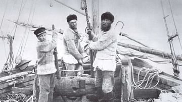
Pomor Seafarers
The Pomors – the indigenous population of Pomomerie (the Arkhangelskaya Oblast region in northeastern Russia that mainly lies south of the White Sea) - were skilled sailors. Pomor hunters and trappers were in Svalbard in the 17th and 18th...
Image
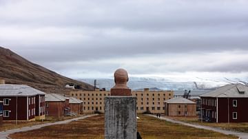
Pyramiden
The abandoned Soviet coal mining settlement of Pyramiden on the Norwegian archipelago of Svalbard.
Image
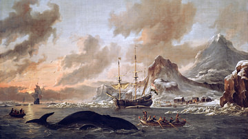
Dutch Whalers off Spitsbergen
Dutch whalers off Spitsbergen, oil on canvas by Abraham Storck, c. 1690.
Collectie Het Scheepvaartmuseum, Amsterdam.