
Illustration


A map illustrating Ibn Battuta's (Abū Abd Allāh Muḥammad ibn Abd Allāh Al-Lawātī, 1304 – c.1368) series of extraordinary journeys across the Islamic world and beyond spanning close to 75,000 miles (120,000 kilometers). A 14th-century Maghrebi explorer and Islamic scholar, he dictated an account of his journeys commonly known as The Rihla (from Arabic رحلة, Journey, Travelogue), providing invaluable insights into the medieval world, offering vivid descriptions of societies, economies, and governance structures from Marocco, Mali, and Spain to India and China. Battuta's descriptions and reflections also provide a unique window into the complexities of intercultural exchange, religious diversity, and political intrigue that characterized the medieval era.
About the Author

Related Images
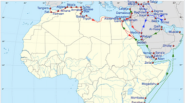
Map of Ibn Battuta's Travels, 1325-32 CE
Ibn Battuta
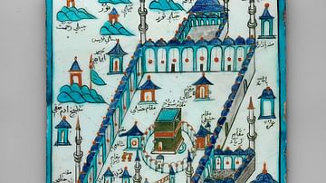
Ka'ba Tile
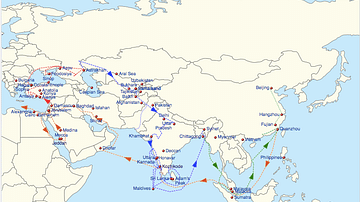
Map of Ibn Battuta's Travels, 1332-47 CE
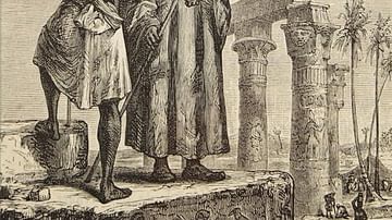
Ibn Battuta in Egypt
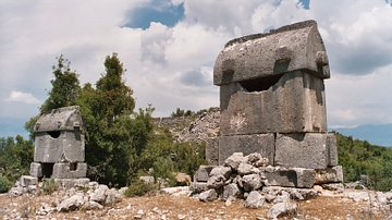
Lycian Tombs
External Links
Cite This Work
APA Style
Netchev, S. (2024, May 09). Ibn Battuta’s Travels, 1325-1354. World History Encyclopedia. Retrieved from https://www.worldhistory.org/image/18929/ibn-battutas-travels-1325-1354/
Chicago Style
Netchev, Simeon. "Ibn Battuta’s Travels, 1325-1354." World History Encyclopedia. Last modified May 09, 2024. https://www.worldhistory.org/image/18929/ibn-battutas-travels-1325-1354/.
MLA Style
Netchev, Simeon. "Ibn Battuta’s Travels, 1325-1354." World History Encyclopedia. World History Encyclopedia, 09 May 2024. Web. 20 May 2024.