
Illustration


A map illustrating the rise and extent of the Mali Empire (c. 1235 - 1672) as it reached its height in the 13th century as one of the most powerful and wealthy states in West Africa. Spanning a vast territory that included modern-day Mali, Senegal, Gambia, Guinea, Niger, Nigeria, and Mauritania, the Mali Empire was renowned for its abundant gold reserves and control over trans-Saharan trade routes.
Under leaders like Mansa Musa, the Mali Empire became one of the wealthiest empires in the world, known for its grand cities, such as Timbuktu and Gao, and its patronage of Islamic scholarship, art, and architecture. Its efficient administration, strong centralized government, and skilled military forces bolstered the empire's prosperity and influence. However, internal strife, external pressures, and the rise of neighboring states (most notably - the Songhai Empire) eventually led to its gradual decline and fall by the late 16th century.
About the Author

Related Images
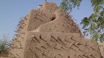
Tomb of Askia Mohammad I, Gao
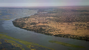
Gao & the Niger River
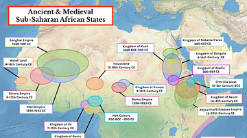
Map of Ancient & Medieval Sub-Saharan African States
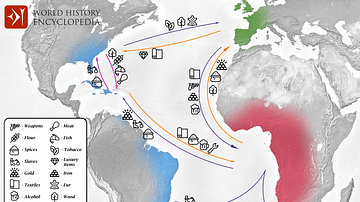
Transatlantic Triangular Trade Map
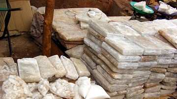
Salt Slabs, Timbuktu
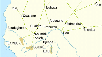
Trans-Saharan Trade Routes
Cite This Work
APA Style
Netchev, S. (2024, April 29). Map of the Mali Empire. World History Encyclopedia. Retrieved from https://www.worldhistory.org/image/18903/map-of-the-mali-empire/
Chicago Style
Netchev, Simeon. "Map of the Mali Empire." World History Encyclopedia. Last modified April 29, 2024. https://www.worldhistory.org/image/18903/map-of-the-mali-empire/.
MLA Style
Netchev, Simeon. "Map of the Mali Empire." World History Encyclopedia. World History Encyclopedia, 29 Apr 2024. Web. 14 May 2024.